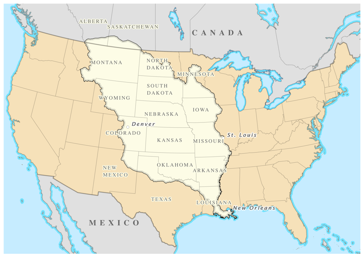
How did the u.s acquire the land of louisiana purchase? and what are the boundaries?
1 Answer
See below
Explanation:
The Louisiana Purchase was an agreement between France, and the US, where the US was given around
The land in this area was much wanted by the United States, but at first, Spain had it. In
At this time, President Jefferson and the Secretary of State worked to resolve the issue, and regain access to the ports. But still, some groups declared war, and tried to seize control of the New Orleans area, and the lower Mississippi. Jefferson told a man named James Monroe to go to France, and draw up an agreement to get some land that was east of the Mississippi, allowing up to $10 million to be exchanged in the process.
Monroe arrived in Paris in April of 1803, and he saw a very different site then he expected to see. The idea that France had to be re-established in the new world was not going well. The threat of war with Britain was looming over them, and they feared that they would just take the land anyways. So, on April 30, the agreement was signed that became known as the Louisiana Purchase.This site may have some more between the lines information if you need some.
The picture below shows the boundaries of the http://purchase.
